Revised: May 5, 2026
North Carolina is one of the most diverse overlanding states in the Southeast. In one long weekend, you can move from rocky Piedmont trails to Blue Ridge forest roads, trout streams, Appalachian ridgelines, blackwater coastal plains, and windswept Atlantic beaches.
For the Jeep Gladiator owner, that variety is the draw.
North Carolina does not offer the wide-open public land of the Mountain West, but it does offer something just as valuable for the East Coast traveler: layered terrain, historic backroads, legal OHV trail systems, national forests, beach-driving access, trout water, waterfalls, small mountain towns, and enough remote-feeling country to make a weekend feel like a real reset.
This guide is not a promise that every dirt road is open, legal, or campable. North Carolina access changes by district, season, weather, closures, private land boundaries, wildlife protection, fire restrictions, and forest orders. Use this as a starting point, then verify every route with current Forest Service maps, Motor Vehicle Use Maps, National Park Service rules, and local regulations before you roll.
Quick Planning Resources
- Before building a route, start with the official sources.
- Use the National Forests in North Carolina Visitor Maps and Guides page to find current maps, road information, and Motor Vehicle Use Maps.
- If you are looking for a true Jeep-friendly trail system, start with the Badin Lake OHV Trail Complex in Uwharrie National Forest.
- If you are researching Pisgah, read the current Pisgah Camping Limitations before assuming roadside camping is allowed.
- For beach driving, check the official Cape Hatteras National Seashore permits and reservations page before heading onto the sand.
- If you are studying longer-distance adventure routes, the Southeast Backcountry Discovery Route is worth researching, but remember that BDR routes are built primarily for adventure motorcycles, not full-size 4x4s.
- Digital tools like onX Offroad, Gaia GPS, Trails Offroad, and AllTrails can help with planning, but they should never replace the legal map. Apps are useful. The MVUM is the authority.
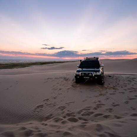
1. Uwharrie National Forest / Badin Lake OHV Trail Complex
If you want one of North Carolina’s most established Jeep-friendly destinations, start with Uwharrie National Forest.
Located in the central part of the state near Troy and Badin Lake, Uwharrie is not the tallest or most remote terrain in North Carolina, but it is one of the most useful public-land destinations for full-size 4×4 owners. The Badin Lake OHV Trail Complex gives drivers access to a designated motorized trail system with rocky climbs, ledges, mud, roots, tight woods, and enough technical terrain to make a stock rig pay attention.
This is a good destination for Jeep owners who want a real trail system rather than just gravel touring.
What to Expect
Uwharrie’s OHV trails are rocky, wooded, and more technical than they may look on a map. Rain changes everything. Dry rock and hardpack can feel manageable, but wet rock and red clay can turn a basic climb into a recovery lesson.
A stock Jeep Gladiator with good all-terrain tires can enjoy portions of Uwharrie, but this is still real trail driving. Skid plates, recovery points, a full-size spare, and a smart right foot matter.
The Forest Service describes the Badin Lake OHV Trail Complex as having multiple designated motorized trails with difficulty ranging from easy to extremely difficult. That is exactly why it works as a destination. You can build the day around your rig, your experience level, and your appetite for dents.
Camping
The broader Badin Lake Recreation Area offers camping options in and around Uwharrie. Some areas allow dispersed camping where legal and not otherwise posted, but rules, setbacks, closures, and posted signs matter.
If you are new to Uwharrie, a developed campground can make a first trip easier, especially if you are bringing family, meeting friends, or testing a new rig setup.
Best Time to Go
Spring and fall are the sweet spots. Summer is hot, humid, buggy, and crowded. Winter can be fun, but icy roots and slick rock are less forgiving than they sound.
Gladiator Up Notes
- Bring recovery gear and know how to use it.
- Do not wheel alone if you are new to the area.
- Air down when appropriate, but air back up before heading home.
- Expect body-width trails, pinstriping, and tight woods.
- Fuel up in Troy, Albemarle, or another nearby town before heading into the forest.
- If your Gladiator is also your daily driver, choose your lines like you still need to get to work Monday.
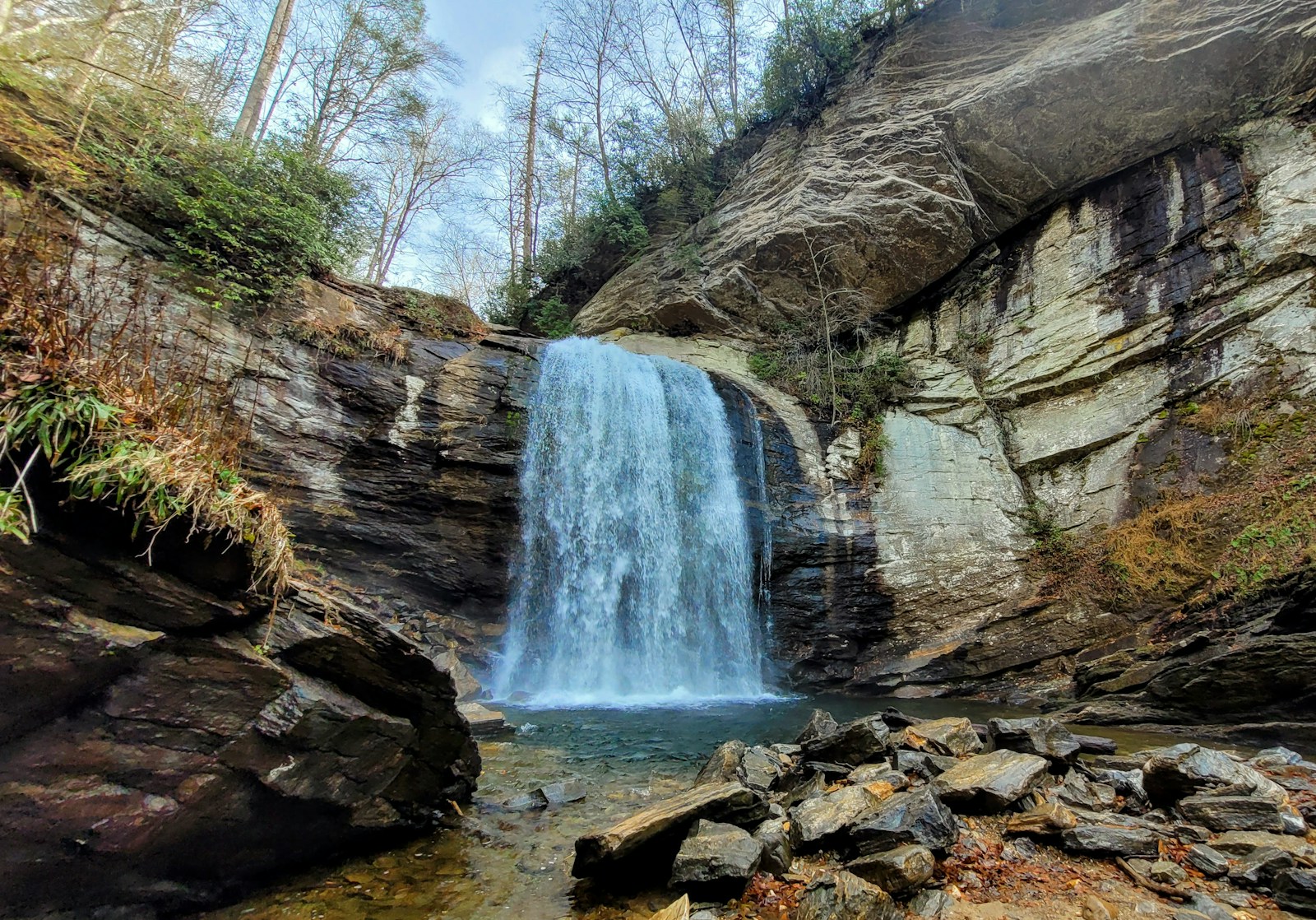
2. Pisgah National Forest Backroads
Pisgah is one of the most beautiful public-land regions in North Carolina, but it also requires the most restraint in how we describe it.
This is waterfall country. Blue Ridge country. Rhododendron tunnel country. Pisgah gives you classic Southern Appalachian scenery, but it is not an anything-goes dispersed-camping playground. Access is heavily managed in places, and current camping restrictions matter.
Before building a trip around roadside camping in Pisgah, read the current Pisgah Camping Limitations. The current Forest Service order prohibits camping within 1,000 feet of roads open to public vehicle travel in the Pisgah Ranger District unless the campsite is specifically designated on the official map. That order is effective until September 1, 2026, unless rescinded earlier.
That means older blog posts, YouTube videos, camping apps, and forum comments may be outdated.
What to Expect
Pisgah’s public roads and forest roads can provide a beautiful backcountry driving experience, but most of this is better described as scenic forest-road touring than off-roading.
Expect gravel roads, narrow lanes, blind curves, cyclists, hikers, fly fishermen, families, and occasional maintenance closures.
The reward is not rock crawling. The reward is the landscape.
Highlights
Depending on the area you choose, Pisgah can put you close to waterfalls, trout streams, Blue Ridge Parkway access, historic logging corridors, hiking trailheads, high-elevation overlooks, Brevard, Asheville, and other mountain towns.
For many travelers, Pisgah is best treated as a hiking and scenic-driving basecamp. It is a place to slow down, not a place to go hunting for trouble.
Camping
Do your homework before assuming roadside camping is allowed. In portions of Pisgah, dispersed camping near open roads is limited to designated sites under the current Forest Service order.
If you want a low-stress weekend, consider developed campgrounds or designated roadside campsites where clearly allowed.
Best Time to Go
Spring and fall are excellent, but fall color season can bring heavy traffic. Summer is lush and green, but popular waterfall corridors get crowded. Winter can be beautiful, but ice, road closures, and short daylight need to be considered.
Gladiator Up Notes
- Treat Pisgah as a scenic backroad and hiking basecamp destination.
- Do not assume every pull-off is a campsite.
- Download offline maps before you lose service.
- Drive slowly around hikers, cyclists, anglers, and blind corners.
- Check Forest Service alerts before you leave the pavement.
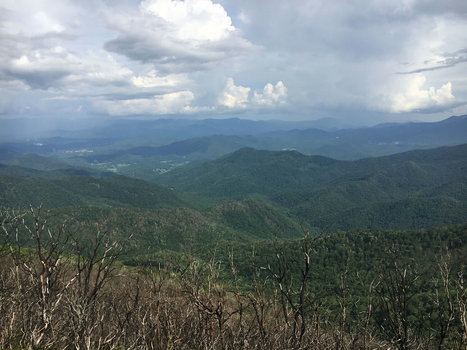
3. Nantahala National Forest: Deep Creek, Wayah, Santeetlah, and the Far Western Mountains
For a true Smokies-adjacent weekend, Nantahala National Forest may be the best balance of scenery, water, forest roads, and practical access.
Nantahala stretches across far western North Carolina, wrapping around places like Bryson City, Franklin, Andrews, Robbinsville, Nantahala Lake, Santeetlah, and the southern edge of the Great Smoky Mountains. It offers a strong mix of mountain driving, trout streams, lake access, hiking, waterfalls, and primitive camping opportunities where legally allowed.
Start your research with the official Nantahala National Forest recreation page, then verify roads and access using the current National Forests in North Carolina maps and guides.
This is the region I’d look at for a long weekend that combines forest-road camping with access to Smokies-style hiking and water.
Deep Creek as an Activity Hub
Deep Creek, just outside Bryson City, is part of Great Smoky Mountains National Park. It is a fantastic daytime destination for creekside hiking, waterfalls, tubing, fishing, and family-friendly adventure. The National Park Service describes the Deep Creek area as a North Carolina-side Smokies destination known for streams, waterfalls, hiking, picnicking, and campground access.
But here is the key distinction:
Deep Creek is not a vehicle-based dispersed camping corridor.
Inside Great Smoky Mountains National Park, camping is limited to official campgrounds and permitted backcountry sites. If you want to sleep out of the Gladiator on a forest road, look outside the park boundary toward Nantahala National Forest and verify legal access with the current MVUM.
The best version of this trip is simple:
Use Deep Creek for the adventure. Use Nantahala for the camp.
Nantahala Route Concept
Rather than promising one perfect loop, treat Nantahala as a basecamp-and-scout region.
Good areas to research include Bryson City and Deep Creek for waterfalls, fishing, tubing, and resupply; Nantahala Gorge for river access, rafting, hiking, and scenic driving; Nantahala Lake, Wayah Road, and Franklin for a strong mountain basecamp feel; Robbinsville, Santeetlah, and Joyce Kilmer for a wilder, less polished experience; and Cherohala-area connections if you want to build a broader Tennessee/North Carolina mountain loop.
This region rewards flexibility. Pick a base area, verify the legal roads, check closures, and build a loose plan with room to adapt.
Important Road Caution
Be careful with older route descriptions that mention NFSR 86 / Connely Creek Road as part of a loop. The Forest Service has listed Connely Creek Road / NFSR 86 as closed until October 2026 for road improvements. Check the current National Forests in North Carolina alerts page before building a trip around any specific forest road.
That is not a small detail. A closed forest road can turn a clean loop into a long backtrack.
Camping
Nantahala can offer primitive and dispersed-style camping opportunities, but legality depends on the specific district, road, closure status, and current Forest Service guidance. Use the MVUM, obey posted signs, avoid water-edge damage, and never create new campsites by driving into vegetation.
Memorial Day, July 4th, Labor Day, and fall color weekends can fill the easy sites quickly. Have a backup plan.
Best Time to Go
Late spring through early fall is prime for creek time, lush forest, and comfortable camping. Fall is hard to beat for color, but it brings more traffic. Winter can be quiet and beautiful, but some roads may be gated, icy, or storm-damaged.
Gladiator Up Notes
- This is one of the best North Carolina regions for a weekend warrior in a Gladiator.
- Expect narrow roads, slick climbs after rain, creekside temptations, and limited cell service.
- Stock 4x4s can enjoy many forest-road approaches in good weather, but mud, leaves, erosion, and washouts can change the trip quickly.
- Carry traction boards, a shovel, a compressor, basic recovery gear, and offline maps.
- Camp gently. Rhododendron, moss, creek banks, and soft shoulders do not recover quickly.
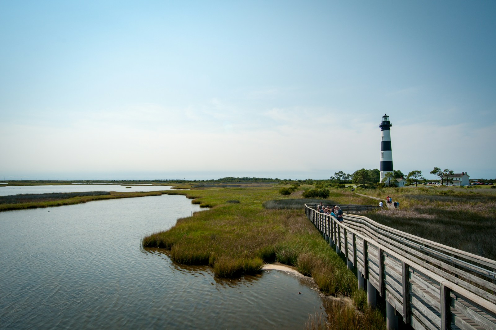
4. Cape Hatteras National Seashore and the Outer Banks
North Carolina is not just mountains and forest roads. The Outer Banks offer one of the most distinctive vehicle-based travel experiences in the Southeast: beach driving.
Cape Hatteras National Seashore is a long, exposed barrier-island landscape of sand, surf, wind, dunes, fishing villages, lighthouses, ferries, and Atlantic weather. It is not overlanding in the Western public-land sense, but it absolutely belongs in a North Carolina adventure guide.
For the Gladiator owner, this is a different kind of trip. Instead of climbing gravel grades and hunting for creekside camps, you are managing sand, salt, tides, wind, soft shoulders, beach access ramps, fishing gear, and corrosion.
ORV Access
Vehicles are allowed on designated ORV routes within Cape Hatteras National Seashore, but a permit is required. The National Park Service states that ORV permits are available online through Recreation.gov.
For current permit pricing, check the official Cape Hatteras fees and passes page. As of the current NPS fee schedule, Cape Hatteras lists a 10-consecutive-day ORV permit and an annual permit option.
Access changes frequently due to weather, tides, erosion, nesting birds, sea turtles, storms, and safety conditions. Always check current beach access before driving onto the sand.
Camping
Cape Hatteras is not dispersed beach camping. Use official campgrounds, private campgrounds, rentals, or other legal lodging options. The National Park Service operates several Cape Hatteras campgrounds, including Oregon Inlet, Cape Point, Frisco, and Ocracoke.
For a Gladiator-based beach trip, Frisco and Cape Point are especially worth researching because of their location on Hatteras Island.
Fishing
Hatteras is famous for surf fishing, sound fishing, pier fishing, and offshore charters. Make sure you have the correct North Carolina coastal fishing license and current regulations before keeping fish.
Best Time to Go
Spring and fall are ideal. Summer is classic beach season, but it brings crowds, heat, bugs, and more competition for campsites and rentals. Winter can be wild, quiet, and beautiful, but weather is less forgiving.
Gladiator Up Notes
- Air down before driving sand.
- Carry a real compressor.
- Bring a shovel and traction boards.
- Do not drive in saltwater.
- Rinse the undercarriage after the trip.
- Watch the tides and avoid soft upper-beach sand.
- Respect closures. Beach habitat is fragile, and closures are not suggestions.
5. Croatan National Forest and the Coastal Plain
Croatan National Forest offers a very different North Carolina experience. Instead of high ridges and trout streams, this is coastal plain country: pine forest, pocosins, blackwater, wetlands, sandy roads, boat launches, and access toward the Crystal Coast.
For overlanders, Croatan is less about dramatic elevation and more about quiet travel, paddling, fishing, birding, and coastal camping.
Start your research with the broader National Forests in North Carolina maps and guides, then verify the specific district rules before assuming a road or camp area is open.
What to Expect
Croatan can include sandy roads, flat forest corridors, wet lowlands, and seasonal access challenges. After heavy rain, low areas can become saturated quickly. Some roads may be easy when dry and sloppy when wet.
This is not a rock-crawling destination. It is a coastal forest and water-access destination.
Camping
Use official Forest Service guidance, designated campgrounds, and legal dispersed opportunities where allowed. Coastal environments are sensitive, and wetland damage is not acceptable. Stay on legal roads and established sites.
Best Time to Go
Spring and fall are best. Summer brings heat, humidity, mosquitoes, ticks, and thunderstorms. Winter can be pleasant and quiet.
Gladiator Up Notes
- Bring bug protection.
- Carry more water than you think you need.
- Watch for soft sand and wet low spots.
- Do not drive into wetlands or around standing water just to see if you can make it.
- Pair the forest with a coastal town or ferry route for a bigger weekend loop.
6. The Southeast Backcountry Discovery Route in North Carolina
The Southeast Backcountry Discovery Route, or SEBDR, is a major adventure route through the Southeast. Officially, BDR describes it as a route running from the Gulf of Mexico in Florida through Alabama, Georgia, Tennessee, and North Carolina before ending in Damascus, Virginia.
This is important: BDR routes are designed primarily for adventure motorcycles, not full-size 4x4s. That does not mean a Jeep owner should ignore the SEBDR. It means you should treat it with respect and research.
How to Use It as a Gladiator Owner
Use the SEBDR as regional inspiration, a scouting framework, a way to identify interesting towns and corridors, and a starting point for building your own legal full-size vehicle route.
Do not blindly download the GPX and assume every mile is appropriate, legal, or smart for a Gladiator.
Current Route Updates Matter
BDR maintains route updates, and those updates matter. Before using any BDR segment, download the latest tracks and read the current SEBDR route updates.
A route that worked for a motorcycle last season may not be the right call for a full-size truck this season.
Best Time to Go
Spring and fall are best. Summer heat and storms can make long pavement-and-dirt days harder. Winter may bring ice, closures, and short daylight in the higher sections.
Gladiator Up Notes
- Verify every segment before using it in a full-size vehicle.
- Avoid motorcycle-only assumptions.
- Build bailouts into the route.
- Watch for private roads, tribal roads, seasonal closures, and narrow mountain lanes.
- Use the SEBDR as a research tool, not a permission slip.
Other North Carolina Adventure Areas Worth Researching
Linville Gorge Area
Linville Gorge is one of the most dramatic landscapes in the state, but it is also heavily used, sensitive, and access-controlled in places. Treat it as a hiking and scenic backroad destination, not a place to improvise vehicle routes.
Because storm damage and closures can affect this area, check the current National Forests in North Carolina alerts page before planning a trip.
Joyce Kilmer / Santeetlah / Robbinsville
This area can make an outstanding mountain weekend, especially if you want quieter forest roads, big trees, lake access, and a wilder feel than the busier Smokies gateways.
It is a strong region for a slow, scenic Gladiator weekend, especially when paired with Nantahala, Cherohala, or Tellico-area planning.
Cherohala Skyway Connections
The Cherohala region gives you a strong Tennessee/North Carolina borderland route concept. Pair it with Tellico, Robbinsville, Santeetlah, or Nantahala for a bigger Appalachian loop.
This is less about technical wheeling and more about stitching together big mountain views, forest roads, small towns, and campable public-land corridors where legal.
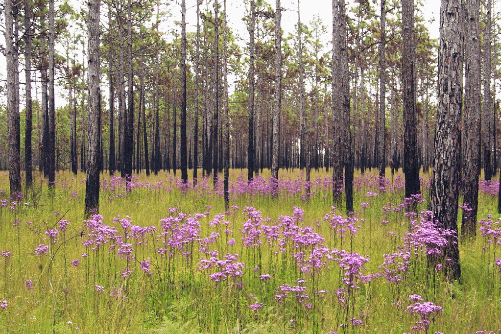
Sandhills Region
The Sandhills offer a different kind of terrain: sandy soil, longleaf pine, game lands, and rolling backroads. Be careful with access rules, private land, and hunting-season conflicts. Game lands are not open-ended overlanding playgrounds.
North Carolina Overlanding Rules of Thumb
1. Legal Access Comes First
If the road is not legal, it is not part of the route. Stay on designated roads, obey MVUMs, and respect closures.
Start with the National Forests in North Carolina maps and guides, then confirm with current local alerts and posted signs.
2. Dispersed Camping Is Not the Same Everywhere
Uwharrie, Pisgah, Nantahala, Croatan, National Park land, state land, and game lands all have different rules. Do not assume a campsite is legal because someone posted it online.
3. Rain Changes the Trip
North Carolina mud, clay, leaves, roots, sand, and rock all change after weather. A road that feels easy on Friday can become a mess by Sunday.
4. Watch Fire Restrictions
Fire rules change with drought and season. Check current restrictions before building a campfire.
5. Respect Hunters, Hikers, Anglers, Cyclists, and Locals
Most of these roads are shared-use corridors. Drive slowly, wave often, keep dust down, and leave gates as you found them.
6. Build a Backup Plan
Especially on holiday weekends. Have a backup campground, motel, or alternate district ready before you leave.
Recommended Gear for North Carolina Trips
For a Jeep Gladiator or similar 4×4, I’d carry:
- Offline maps
- Current MVUMs
- Tire repair kit
- Full-size spare
- Air compressor
- Tire deflator
- Traction boards
- Shovel
- Tow strap or kinetic rope
- Soft shackles
- Basic tool kit
- First aid kit
- Headlamp
- Rain shell
- Bug spray
- Extra water
- Trash bags
- Fire extinguisher
- Fishing license if applicable
- Recovery points front and rear
North Carolina may not look as remote as Utah or Colorado, but don’t let the green trees fool you. A slick hill, bad cell service, and a poor decision can still turn a weekend into a long walk.
Final Take
North Carolina is a strong overlanding and 4×4 touring state if you approach it the right way. It is not about pretending every gravel road is a trail. It is about connecting legal access, public land, small towns, old forests, rivers, beaches, and mountain corridors into trips that fit real life.
- For rocky Jeep trails, start with Uwharrie.
- For mountain scenery and waterfall-country backroads, research Pisgah, but respect the current camping limits.
- For Smokies-adjacent forest-road camping and weekend basecamp potential, look hard at Nantahala.
- For sand, salt, surf fishing, and beach driving, put Cape Hatteras on the list.
- For long-distance route inspiration, study the SEBDR, but remember it was built for adventure motorcycles first.
- North Carolina rewards the traveler who does his homework. Plan clean. Drive legal. Camp lightly. Leave the place better than you found it.
Tread lightly and Gladiator Up! – Doug