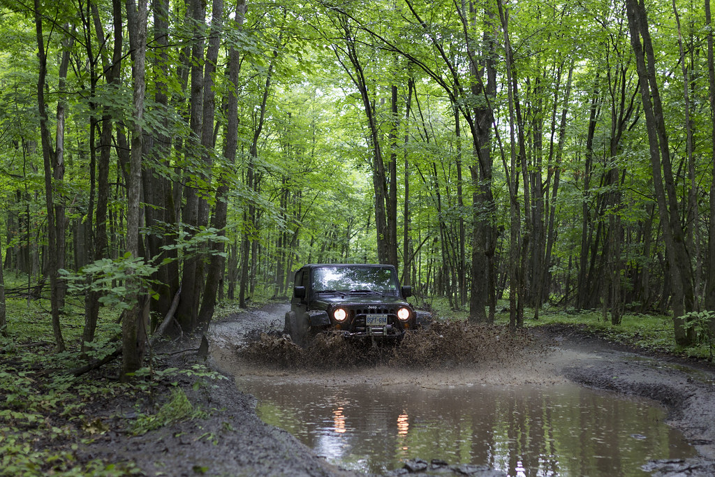
Overlanding in the Southeast near government bases, laboratories, or sensitive areas offers unique adventures, blending rugged trails with intriguing histories and curiosities like military testing grounds or rumored Bigfoot sightings. Below, I’ll highlight three notable destinations in the Southeast, recommend tools for planning routes to avoid restricted areas, and explore the curiosities that make these spots compelling for vehicle-based adventure travel.

1. Talladega National Forest Near Anniston Army Depot, Alabama
The Talladega National Forest, spanning over 392,000 acres in eastern Alabama, offers a network of overland routes like the Talladega Scenic Drive and off-road trails in the Choccolocco Management Area, ideal for 4×4 enthusiasts. Nearby, the Anniston Army Depot, a major military facility for tank and vehicle maintenance, adds an air of intrigue with its restricted zones and history of chemical weapons storage (now decommissioned). Overlanders can explore trails like the Skyway Motorway or camp at dispersed sites near Cheaha Mountain, Alabama’s highest point at 2,407 feet, while staying clear of depot boundaries. The forest is also a Bigfoot hotspot, with four reported sightings in Talladega County, the most recent in July 2014, per the BFRO database (https://www.bfro.net). Check out USDA Forest Service’s Talladega National Forest page for trail maps and camping info.

2. Ocala National Forest Near Naval Air Station Jacksonville, Florida
Ocala National Forest, covering 607 square miles in central Florida, is a prime overlanding destination with sandy trails, natural springs, and the Ocala North OHV Trail System for off-road rigs. Its proximity to Naval Air Station (NAS) Jacksonville, a key military aviation hub about 60 miles away, adds a layer of curiosity, as the base is known for its role in anti-submarine warfare and occasional UFO-related rumors among locals. Overlanders can navigate the forest’s 4×4-friendly trails like the Delancy Loops or camp near Juniper Springs, but must avoid restricted military training areas to the east. The forest has one Bigfoot sighting listed in Marion County (August 1992, per BFRO), fueling campfire tales. Visit USDA Forest Service’s Ocala National Forest page for trail details and restrictions.

3. Pisgah National Forest Near Oak Ridge National Laboratory, Tennessee
Pisgah National Forest in western North Carolina, just across the state line from Tennessee, offers over 500,000 acres of rugged trails, waterfalls, and scenic byways like the Blue Ridge Parkway, perfect for overlanders seeking technical routes. Roughly 100 miles away lies Oak Ridge National Laboratory in Tennessee, a historic Manhattan Project site and current leader in nuclear and energy research, surrounded by restricted zones due to its sensitive work. Trails like the Harmon Den or Max Patch Road provide stunning views and dispersed camping, but overlanders must steer clear of private or government lands near Oak Ridge. The area’s mystique includes Cold War history and occasional Bigfoot reports, with three sightings in nearby Madison County, Alabama, the latest in February 2009 (per BFRO). Explore more at USDA Forest Service’s Pisgah National Forest page.
Tools for Planning Routes and Avoiding Restricted Areas
Navigating near sensitive areas like military bases or research labs requires precise planning to avoid restricted zones, which can lead to fines, detentions, or encounters with security. Here are the best tools for route planning, emphasizing land ownership and real-time updates:
- onX Offroad App: This GPS-based app provides detailed offline maps with color-coded layers for public lands, private property, and restricted government areas (e.g., military or lab perimeters). It’s ideal for plotting routes around Anniston Army Depot or Oak Ridge, with real-time alerts for boundaries. Download from the App Store.
- Gaia GPS: Offers topographic maps, satellite imagery, and land management layers, including BLM, Forest Service, and DoD boundaries, perfect for ensuring you stay on public trails in forests like Talladega or Pisgah. Community-shared tracks help verify safe routes. Get it at Gaia GPS.
- iOverlander App: A free, crowd-sourced tool for finding campsites, water sources, and user notes on restricted areas or road closures near bases like NAS Jacksonville. It’s great for real-time updates from other overlanders. Visit iOverlander.
Supplement these with paper backups like Benchmark Maps’ Alabama, Florida, or North Carolina atlases, which show land ownership, and check official government sites (e.g., BLM or DoD) for the latest restrictions. Forums like Overland Bound also provide local insights.

Exploring the Curiosities: History, Myths, and Bigfoot
The Southeast’s sensitive areas spark fascination beyond their trails. In Talladega National Forest, the Anniston Army Depot’s history of chemical weapons storage invites speculation about Cold War secrets, while BFRO’s four Bigfoot sightings in the county (latest in 2014) fuel campfire stories of elusive creatures—perfect for overlanders with a Bigfoot hunting kit like trail cameras and audio recorders. Ocala’s proximity to NAS Jacksonville ties into UFO lore, with locals sharing tales of unexplained lights, complemented by its single Bigfoot report for added mystery. Pisgah, near Oak Ridge, offers a window into Manhattan Project history, with nearby museums like the American Museum of Science and Energy (AMSE) detailing nuclear breakthroughs, while Bigfoot sightings in nearby Alabama counties add a cryptid twist. Use binoculars for distant views of facilities, visit local historical sites, and respect boundaries to stay safe.
Overlanding in the Southeast near these sites blends adventure with intrigue, but preparation is key. Equip your rig, plan with the right tools, and dive into the stories that make these areas unforgettable.
Note: Always verify current restrictions with local authorities or official websites before heading out, as military and lab areas may have dynamic closures. For Bigfoot enthusiasts, cross-reference routes with BFRO’s Alabama sightings (101 total, latest in Cleburne County, February 2023) at BFRO.net.
Tread lightly and Gladiator Up! – Doug

