

From the Appalachian foothills to the white-sand Gulf Coast, Alabama is a hidden gem for overlanding. Explore legendary routes like 600-1 and 600-2 in Talladega National Forest, wind through the rocky challenges of “Alabama’s Rubicon,” or enjoy the scenic byways that link mountains, waterfalls, and historic towns. Our curated maps, videos, and route guides make it easy to plan your next Overlanding adventure in the Heart of Dixie.
Links to Routes & Maps
- Alabama Rubicon
- Greater Talladega National Forest
- Little River Backcountry Road
- Bankhead National Forest – “Land of A Thousand Waterfalls”
- AllTrails.com | 10 Best Off-road Driving Trails in AL
Alabama offers a variety of overlanding opportunities, ranging from beginner-friendly trails to more challenging terrains. Here are some resources and popular locations to help you plan your Alabama overlanding adventure:
Apps and digital resources
- Gaia GPS: A popular backcountry navigation app adopted by the off-road community. Offers various map layers, including USFS Motor Vehicle Use Maps (MVUMs) for identifying open trails and restrictions. Gaia GPS also allows users to plan routes, download maps for offline use, and sync with Apple CarPlay.
- onX Offroad: This GPS app offers detailed satellite imagery, topographic maps, and information on trail accessibility and closures. It also provides trail descriptions and difficulty ratings.
- Trails Offroad: Offers detailed information on over 2,400 overlanding routes, including difficulty ratings, waypoints, and the ability to upload routes directly to Gaia GPS.
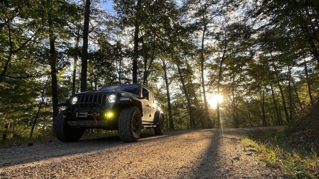
The Alabama Rubicon — Talladega National Forest
The “Alabama Rubicon” is an unofficial name used by the overlanding and 4×4 community for one of Alabama’s best-known public-land backcountry drives through Talladega National Forest. The heart of the route is Forest Service Road 600-1 — Lower Skyway Motorway — and neighboring FS 600-2, combining rugged Appalachian forest, ridgeline views, rocky sections, washouts and enough changing terrain to make this far more than an ordinary gravel-road tour. (Trails Offroad)
FS 600-1 runs roughly 14 miles and is generally the more approachable of the pair, while conditions on 600-2 can become considerably more technical where erosion, mud and deep ruts develop. Both roads can change dramatically after heavy rain, so yesterday’s moderate trail can become tomorrow’s recovery exercise. Recent onX reports on 600-2 have documented deep ruts, mud holes and sections capable of lifting a tire. (onX Maps)
Background: Expedition Portal — “The Alabama Rubicon”
https://expeditionportal.com/the-alabama-rubicon
Suggested Route & Direction
For a south-to-north run, begin with FS 600-1 / Lower Skyway Motorway near the Sylacauga–Millerville area, then work north through the Talladega road network toward FS 600-2 and the Cheaha area. Lower Skyway is commonly recommended northbound, and this direction creates a natural progression toward Alabama’s highest country and Cheaha State Park. (Trails Offroad)
The nearby FS 600-3 Old Skyway is a short, much easier section at the foot of Cheaha Mountain and can be incorporated depending on your exact route. (onX Maps)
Explore FS 600-1 on onX Offroad
https://refer.onxmaps.com/stokedcre8tive?utm_source=gladiatorup.com
Route note: Do not assume every road shown on a recreational mapping app is legally open to motor vehicles. The Forest Service Motor Vehicle Use Map (MVUM) is the controlling reference for designated motorized roads, and USFS advises visitors to check the current MVUM before traveling. (Forest Service)
National Forests in Alabama — Maps & Motor Vehicle Information
https://www.fs.usda.gov/r08/alabama/maps-guides
Best Time of Year
Spring and fall are the sweet spots. April through June brings fresh growth and generally pleasant mountain weather, while mid-September through November offers some of the best fall scenery in the Talladega Mountains. Summer is certainly possible, but expect heat, humidity and heavier vegetation. (Forest Service)
More important than the month is the weather immediately before your trip. Heavy rain can turn ruts, clay, loose rock and mud holes into substantially harder obstacles.
Camping & Regulations
- Dispersed camping is generally permitted for non-hunters in the general forest, unless an area is specifically closed or restricted. Hunters using state Wildlife Management Areas are subject to different rules and must use designated hunter camps. (Forest Service)
- Turnipseed Campground is the most relevant Forest Service primitive campground for this route and sits near Cheaha Wilderness and AL-281. It is currently operated seasonally from March 1 through December 1. (Forest Service)
- Cheaha State Park provides developed camping, cabins and other amenities near the logical northern end of the trip.
- Always check current Forest Service alerts, road closures, fire restrictions and the MVUM before departure. The Forest Service specifically directs Talladega visitors to current motor-vehicle-use maps when determining which roads are open. (Forest Service)
- Stay on designated motorized routes and practice Leave No Trace principles.
Turnipseed Campground — U.S. Forest Service
https://www.fs.usda.gov/r08/alabama/recreation/turnipseed-campground
Talladega National Forest — Current Recreation Information
https://www.fs.usda.gov/r08/alabama/recreation/talladega-national-forest-0
Overlanding Tips
- High-clearance 4×4 recommended. A stock, capable 4×4 can run the route in favorable conditions, but all-terrain tires and adequate clearance are smart insurance.
- Conditions matter more than ratings. Rain can transform washed-out and rutted sections quickly.
- Carry real recovery gear. Traction boards, recovery strap, rated recovery points and a shovel belong in the kit; traveling with a second rig is preferable.
- Fuel and supplies: Sylacauga makes sense on the southern end; Talladega, Anniston and Heflin provide useful resupply options farther north. Moulton does not—it’s Bankhead country.
- Download offline navigation before entering the forest. Cell service can be unreliable.
- Use the MVUM for legality and onX Offroad for practical navigation and current trail intelligence.
- Stay on designated routes, respect gates and closures, and remember that bypassing an obstacle does not mean creating a new line through undisturbed ground.
onX Offroad — GladiatorUp Referral
https://refer.onxmaps.com/stokedcre8tive

Bankhead NF — Land of a Thousand Waterfalls
Bankhead National Forest, located in northwestern Alabama, may be the state’s best all-around destination for vehicle-based adventure travel. Nicknamed the “Land of a Thousand Waterfalls,” the forest combines an extensive network of designated Forest Service roads with dense hardwood forest, sandstone bluffs, deep ravines, creeks, waterfalls and some of the wildest scenery in Alabama.
For overlanders, Bankhead’s appeal is less about one famous technical trail and more about the ability to string together miles of gravel and primitive forest roads into a genuine multi-day journey. Conditions range from smooth maintained gravel to narrower roads with ruts, mud, erosion and occasional rough sections that can change considerably after heavy rain.
The Sipsey Wilderness lies at the heart of Bankhead and is closed to motorized travel. That boundary is part of what makes the area special: overlanders can explore the surrounding Forest Service road network, stop at established trailheads and recreation areas, then hike into the wilderness on foot.
Bankhead National Forest — U.S. Forest Service
https://www.fs.usda.gov/r08/alabama/recreation/bankhead-national-forest-0
Suggested Route & Direction
Rather than recommending a short collection of disconnected forest roads, GladiatorUp is currently developing the Bankhead Forest Grand Traverse—a roughly 165–180 mile, 3-day / 2-night route designed to experience Bankhead as one continuous journey.
The working route begins near the Bankhead Ranger District / Double Springs area and travels clockwise through the forest, combining approximately 110–135 miles of unpaved travel with short paved connectors. Brushy Lake Recreation Area is planned as the first overnight stop, with Corinth Recreation Area anchoring Night 2.
The route is designed to wrap the Sipsey Wilderness rather than enter it, linking Forest Service roads with waterfalls, trailheads, recreation areas and short hiking opportunities along the way.
Route Status: Planning and map verification are underway. Final mileage, road selections and downloadable navigation will be published after field reconnaissance. Until then, consider the Grand Traverse a developing GladiatorUp route—not a turn-by-turn trail guide.
Must-See Stops
- Brushy Lake Recreation Area — A quiet 33-acre lake and campground that makes a natural base or overnight stop while exploring the northern forest.
- Kinlock Falls — One of Bankhead’s most recognizable waterfalls and an easy side trip. Note that current Forest Service regulations restrict camping within one-half mile of the falls without written permission.
- Sipsey River Picnic Area & Trailhead — One of the best staging points for leaving the Jeep behind and exploring the Sipsey Wilderness on foot.
- Caney Creek Falls — A worthwhile hike-in waterfall for travelers willing to add some trail time to the trip. Many Bankhead waterfall routes are remote and should not be treated like maintained park trails.
- Natural Bridge — A worthwhile short diversion to one of Alabama’s best-known natural rock formations.
- Corinth Recreation Area — Developed camping on Lewis Smith Lake and our planned second-night anchor for the Grand Traverse.
Best Time of Year
- Spring: Excellent waterfall flow, green forest and generally comfortable temperatures.
- Fall: Arguably Bankhead at its best—cooler weather, hardwood color and good camping conditions.
- Summer: Completely doable, but expect heat, humidity, insects and rapidly changing road conditions following thunderstorms.
- Winter: Fewer crowds and excellent visibility through the forest, although cold rain, mud and occasional freezing conditions can make remote roads more demanding.
Camping & Regulations
- Dispersed camping is available in portions of the general forest where it is not otherwise restricted or posted, but do not assume every pull-off is a legal campsite.
- Brushy Lake Recreation Area provides developed camping and makes a good primitive-feeling alternative to the larger lakefront campgrounds.
- Clear Creek Recreation Area and Corinth Recreation Area offer developed camping on Lewis Smith Lake. Both currently require reservations for camping.
- Kinlock Falls has specific camping restrictions: camping without written permission is prohibited within one-half mile of the falls, Kinlock Spring and Kinlock Shelter.
- Vehicle travel should remain on roads designated for motorized use. The current Bankhead Motor Vehicle Use Map (MVUM) should be treated as the legal baseline for route planning.
- Forest roads, gates and closures can change. Check current U.S. Forest Service alerts before departure.
Bankhead MVUM & Visitor Maps — U.S. Forest Service
https://www.fs.usda.gov/r08/alabama/maps-guides
Overlanding Tips
- High-clearance 4×4 is recommended. Bankhead contains plenty of easy forest-road travel, but rain, erosion and seasonal road wear can change conditions quickly.
- Don’t confuse a line on a mapping app with legal access. Use the current Forest Service MVUM to determine designated motorized roads.
- Download offline maps before entering the forest. Cell service is unreliable in many of the deeper hollows.
- Carry basic recovery gear, a full-size spare and enough fuel to avoid depending on an immediate exit from the forest.
- Build time into the itinerary for hiking. Bankhead rewards getting out of the vehicle—the waterfalls, bluffs and Sipsey Wilderness are a huge part of the reason to come.
- Treat water crossings and mud according to current conditions, not somebody else’s trail report from six months ago.
Recommended Navigation: onX Offroad
https://refer.onxmaps.com/stokedcre8tive
GladiatorUp may receive referral credit when you use our onX link. I’m also an onX Offroad Trail Guide and use the platform for route research, offline navigation and field reconnaissance.

Southeast Backcountry Discovery Route (SEBDR) — Selma to Sylacauga
The Selma-to-Sylacauga section of the Southeast Backcountry Discovery Route covers approximately 172 miles across central Alabama, beginning in historic Selma and working northeast through rolling county roads and the Oakmulgee Ranger District of Talladega National Forest before finishing in Sylacauga.
This stretch marks a noticeable change in terrain from the flatter country farther south. Roads become hillier, forest corridors tighter, and the soil increasingly clay-based—making otherwise manageable roads considerably slicker after rain. Along the way, the route passes Heiberger Grocery, crosses narrower backcountry roads and a water crossing, travels through Thorsby, and eventually climbs toward Flagg Mountain, traditionally recognized as the southern beginning of the Appalachian Mountains.
One important update: Red Sand Road is now part of the primary SEBDR route. It was previously designated as an optional harder section, but BDR incorporated it into the main track following road improvements in its June 2026 route update.
Official SEBDR Route Information & Current Tracks
https://ridebdr.com/sebdr/
SEBDR Route Updates
https://ridebdr.com/news/sebdr-route-updates/
Terrain & Driving Experience
- Rolling gravel and dirt county roads mixed with National Forest roads.
- Clay-based surfaces that can become extremely slick following rain.
- Narrower backcountry roads through the Oakmulgee Ranger District.
- A water crossing and occasional rutted or rough sections.
- Increasing elevation and more Appalachian character as the route approaches Flagg Mountain and Sylacauga.
Conditions can change quickly. The SEBDR is maintained as a route for adventure motorcycles, so its inclusion here should not be interpreted as a guarantee that every section will always be suitable for a full-size 4×4. Drivers should verify current road access, conditions and vehicle suitability before committing to unfamiliar sections.
Highlights Along the Route
- Selma, Alabama — The section begins in one of Alabama’s most historically significant cities.
- Oakmulgee Ranger District — The first substantial National Forest terrain encountered after leaving Selma.
- Heiberger Grocery — A classic rural general-store stop along the route with food, snacks and fuel when available.
- Thorsby, Alabama — A useful mid-route opportunity for food, fuel and supplies.
- Flagg Mountain — Home to a historic CCC fire tower and commonly recognized as the southern beginning of the Appalachian Mountain range.
- Red Sand Road — Formerly the optional harder route, now incorporated into the primary SEBDR track following road improvements.
- Sylacauga, Alabama — Section endpoint with fuel, food and lodging before the SEBDR continues toward Cheaha and Georgia.
Camping & Overnight Options
Camping opportunities exist along the corridor, but do not assume that any roadside pull-off is a legal dispersed campsite. Much of the route crosses a mixture of county roads, National Forest land and other property boundaries.
BDR currently identifies several useful overnight options in or near this section, including camping and cabins around Flagg Mountain, River Run Campground, and the Pinhoti Outdoor Center near Sylacauga.
When traveling National Forest roads, consult current Forest Service maps and posted regulations before selecting a campsite.
Oakmulgee District Maps & MVUM — U.S. Forest Service
https://www.fs.usda.gov/r08/alabama/maps-guides
Overlanding Tips
- Best Seasons: Spring and fall generally offer the most comfortable temperatures. Alabama summer heat and humidity can be substantial.
- Watch the rain: Clay is the defining variable on this section. A road that is straightforward when dry can become exceptionally slick after a storm.
- Navigation: Download the latest official BDR GPX tracks immediately before your trip rather than relying on an older saved route.
- Offline maps are strongly recommended. Cell coverage can disappear quickly in the Oakmulgee backcountry.
- Vehicle Prep: Good all-terrain tires, adequate clearance, rated recovery points and basic recovery equipment are recommended.
- Use the MVUM: Where the route enters National Forest land, use the current Forest Service Motor Vehicle Use Map to verify designated motorized roads.
- Respect gates and closures: Never drive around a closed gate or attempt to bypass a posted road closure.
BDR officially supports importing its GPX tracks into onX Offroad, which BDR named its Official Navigation App in 2025. Download the current BDR tracks first, import them into onX, and save offline maps before heading into areas with limited service.
onX Offroad — GladiatorUp Referral
https://refer.onxmaps.com/stokedcre8tive
GladiatorUp may receive referral credit when you use our onX link. I’m also an onX Offroad Trail Guide and use the platform for route research, offline navigation and field reconnaissance.
Conecuh NF — FS Roads 311, 305 & 332
The Conecuh National Forest in southern Alabama offers a completely different flavor of overlanding from the Appalachian terrain farther north. Here, sandy forest roads wind through longleaf pine country, wetlands and open savannas, creating a quiet, easy-going destination for wildlife viewing, camping and backroad exploration.
For accessible and beginner-friendly adventure travel, the Forest Service roads around Conecuh are hard to beat. FS 311 (Miller Creek Road), FS 305 (Grab Mill Rd / XC Rd), and FS 332 (Hogfoot Road) provide a good backbone for exploring the forest, with pine-lined roads, occasional water crossings and generally mellow terrain.
This is less about technical wheeling and more about slowing down, exploring side roads and enjoying one of Alabama’s most distinctive landscapes.
Conecuh National Forest — U.S. Forest Service
https://www.fs.usda.gov/r08/alabama/recreation/conecuh-national-forest-0
Terrain & Driving Experience
- Mostly sand, packed dirt and gravel, with slick or muddy sections developing after heavy rain.
- Generally flat, full-width Forest Service roads that make Conecuh approachable for beginners.
- Several routes include shallow water crossings, bridges and wetland corridors.
- Many roads are easy in dry conditions, but 4×4 and decent all-terrain tires give you more margin when conditions deteriorate.
- FS 305 and FS 311 provide some of the longer continuous drives, while shorter roads such as FS 332 make good connectors for building a larger loop.
Highlights Along the Route
- Longleaf Pine Forests — Conecuh is part of an ongoing effort to restore and maintain the historic longleaf pine ecosystem, habitat that supports several notable Southern species.
- Wildlife — Keep an eye out for red-cockaded woodpeckers, gopher tortoises and other wildlife associated with the longleaf pine ecosystem.
- Open Pond Recreation Area — The forest’s primary developed camping destination and an excellent base camp for exploring the surrounding road network.
- Blue Lake Recreation Area — A day-use picnic and swimming area located only a short drive from Open Pond.
- Solitude & Space — Conecuh generally feels quieter and more open than Alabama’s mountain forests, making it particularly well suited to relaxed exploration and shakedown trips.
Open Pond Recreation Area — U.S. Forest Service
https://www.fs.usda.gov/r08/alabama/recreation/open-pond-recreation-area
Blue Lake Recreation Area — U.S. Forest Service
https://www.fs.usda.gov/r08/alabama/recreation/blue-lake-recreation-area
Camping & Regulations
- Dispersed camping is available within the general forest where not otherwise restricted or posted, but don’t assume every roadside clearing or pull-off is an established campsite.
- Open Pond Recreation Area offers developed camping and serves as the most convenient base for multi-day exploration of Conecuh.
- Open Pond currently has specific occupancy limits, including a 14-day camping limit during the March 1–September 30 period.
- Blue Lake is day-use only, not an overnight camping area.
- Hunting is an important seasonal use of the forest. Be especially aware of hunters during fall and winter and make yourself visible when hiking away from the vehicle.
- Check current Forest Service alerts, fire restrictions and the Conecuh Motor Vehicle Use Map (MVUM) before heading out.
National Forests in Alabama — Maps & MVUMs
https://www.fs.usda.gov/r08/alabama/maps-guides
Overlanding Tips
- Best Seasons: Late fall through early spring generally provide cooler temperatures and fewer insects. Summer brings serious heat, humidity and mosquitoes.
- Navigation: FS 305, 311 and 332 make useful starting points, but Conecuh’s road network branches extensively. Download offline maps before entering the forest.
- Conditions: Don’t underestimate wet sand, clay or muddy low spots simply because the road carries an easy rating.
- Vehicle Prep: Airing down can improve comfort and traction in loose sand. Carry basic recovery gear even on an easy route.
- Local Etiquette: Forest roads are shared with hunters, Forest Service personnel and other users. Keep speeds reasonable and give working vehicles plenty of room.
- Wildlife: Stay on designated roads and avoid disturbing sensitive habitat, particularly around marked red-cockaded woodpecker areas.
- Bug Gear: Repellent is not optional in warm weather. Conecuh mosquitoes can make you reconsider several of your life choices.
Explore Conecuh with onX Offroad
https://refer.onxmaps.com/stokedcre8tive
GladiatorUp may receive referral credit when you use our onX link. I’m also an onX Offroad Trail Guide and use the platform for route research, offline navigation and field reconnaissance.

More Alabama Backcountry to Explore
Little River Canyon National Preserve deserves a place on the Alabama overlanding radar. The Preserve’s Wildlife Management Area contains approximately 23 miles of unpaved numbered backcountry roads, many requiring 4WD and offering access to wooded hills, river crossings, hiking trails and some remarkably remote country in northeastern Alabama.
This is better approached as a daytime 4×4 exploration destination than a traditional overnight overland route. Only street-legal vehicles are permitted on the numbered roads, road conditions can deteriorate substantially following heavy rain, and camping is not allowed within the Preserve.
Little River Canyon Backcountry Roads — National Park Service
https://www.nps.gov/liri/planyourvisit/wildlife-management-area.htm
Little River Canyon is on our list for a future GladiatorUp route reconnaissance and dedicated guide.
Before You Go
- Stay legal: Use designated motorized roads and obey gates, closures and posted restrictions.
- Verify conditions: Forest roads can change dramatically after storms, flooding, logging activity or seasonal maintenance.
- Download offline navigation: Cell coverage throughout Alabama’s backcountry can be unreliable.
- Check camping regulations: Rules vary between National Forests, WMAs, state lands and National Park Service property.
- Tread Lightly: Stay on established roads, avoid creating bypasses around obstacles and pack out everything you bring in.
Recommended Navigation — onX Offroad
https://refer.onxmaps.com/stokedcre8tive
GladiatorUp may receive referral credit when you use our onX link.
Tread Lightly and Gladiator Up! – Doug
Revised: Aug. 13, 2026